DESIGN: Correctly determining the layout of sub-surface utilities can be a major challenge to planners of tram and light rail lines. Bentley Systems aims to give civil and design engineers greater certainty about sub-surface utility modelling by extending its OpenRoads software suite to include a ‘conflict matrix’ which integrates pre-existing map data with site surveys in a single three-dimensional graphical interface.
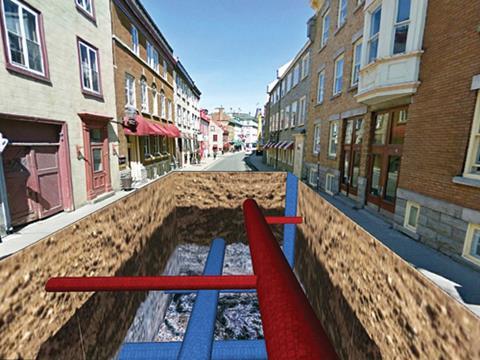
Bentley researchers in Québec hope to add to this functionality by combining ground-penetrating radar data with a panoramic image of the work site to create a ‘virtual excavation’.
According to the research team, displaying hidden objects in an augmented reality context has so far proved extremely challenging, but the ability to view GPR data at the exact location it was scanned could assist engineers in selecting an appropriate area for on-site excavation.

